Digital Health Geographies Research Group
How do digital geographical data foster innovative understandings of space, place, and health? How can we reconcile spatial analysis and machine learning with the need for local knowledge and situatedness in health/medical geographical research? These are the key questions guiding our thinking and research, as pursued in the range of projects listed below. |
Members


Former Members

Research projects
The rapid nascence of data availability, powerful algorithms, and quantitative methodology are necessitating novel conceptualisations of “digital”, serving both as an applied means of constructing information and as an arena for critical inquiry into emergent modes of representation. With a broad focus on the interplays between human health and social/built/natural environments, the Digital Health Geographies Research Group explores the confluence of applied machine learning and the analysis of situated, community-scale sociocultural practice through empirical study.
REKKE – Resilienz durch Kulturlandschaft im Klimawandel
Resilienz durch Kulturlandschaft im Klimawandel
Die Auswirkungen des Klimawandels in Bayern bedeuten in der Zukunft eine Tendenz zu länger anhaltenden Hitzephasen im Sommer mit teils deutlich über 40°C. Dadurch steht Kulturlandschaft in ihrer resilienzstiftenden und gesundheitsfördernden Wirkung für die Bevölkerung vor großen Herausforderungen. Es geht dabei nicht nur um den Verlust einer vertrauten ästhetischen Qualität, sondern um konkrete Einschränkungen als Erholungsort, Ort sozialer Teilhabe und Raum für körperliche Aktivität und Sport. Dies betrifft die Nutzbarkeit des heimischen Balkons genauso wie sommerliche Freiluftveranstaltungen oder die wöchentliche Walking-Gruppe im nahen Wald. Die Folgen des Klimawandels treffen dabei nochmals verstärkt vulnerable Bevölkerungsgruppen, die ohnehin nur eingeschränkten Zugang zu gesundheitsfördernden Kulturlandschaftselementen haben.
GeoDatRights (BMBF)
VIBRANCE – Violence in Brazil: Analysis of Community Environments
Brazil is known worldwide for its vibrant cultural diversity and beautiful landscapes. However, increasing awareness of deeply embedded social issues such as social inequality, poverty, and violence underscores the need for more nuanced understandings of their interrelations with space and place. VIBRANCE is a collaborative study bringing together researchers from Brazil, Germany, and Canada to develop and implement innovative interdisciplinary approaches to studying space, place, and violence. By using advanced quantitative techniques and situated qualitative inquiry, VIBRANCE assesses various domains of social and spatial risk factors of violence at multiple scales across the country, seeking to advance understandings of the complex geographies of violence and to identify policies and programmes to reduce the burden of violence in Brazilian communities.
External Partners:
- Dr. Kevan Guilherme Nóbrega Barbosa, Centro Universitário CESMAC, Macieó, Brazil.
Theses:
- Anton Leutner, BA Thesis: Spatialities of Violence: Analysis socioeconomic patterns of gun violence in Rio de Janeiro and Recife, Brazil
- Antonia Bauer, BA Thesis: Instrumentalization of space through violence
- Julian Hofmann, BA Thesis: Gemeinwohlökonomie im brasilianischen Kontexten
Narratives of Crisis
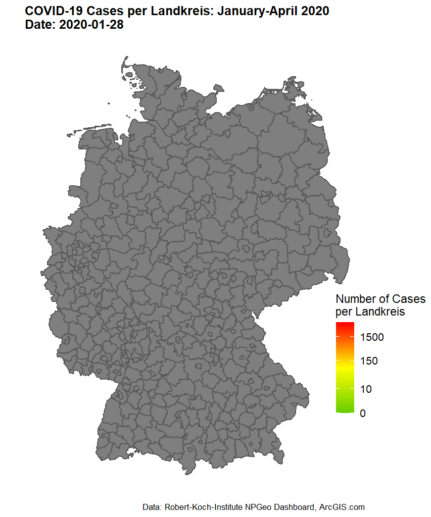
Using COVID-19 as an example, the Digital Health Geographies research group uses automated knowledge mining methods to investigate, on the basis of different types of text, (1) which spatial-cognitive strategies are used to consistently locate crises outside one’s living environment, (2) which events modify these narratives over time, and (3) how newly emerging arguments discursively re-bind these events. The aim of the study is to alleviate the socioeconomic consequences of crises by revealing the suspensive character of certain narratives for necessary political decision-making processes.
ISOGW
ISOGW- Isoscapes Groundwater
STAGE – Spatial Transcoding of Artificial Geographical Environments
Open Worlds, Digital Landscapes: digital inscriptions of cultural mythologies in playable open worlds and built environments.
In the field of Place Research, visual spaces, both real-world and artificial, provide a stage for shared social practice. There exist different forms of visual spaces, ranging from complete virtual worlds over augmented reality to geoservices, which add digital information on site.
Individual practice is bound to the participant’s specific experiences and cultural context. As it can be revealed by the metaphor of game and play, we explore how these aspects are represented, expressed, and enacted in different game environments. Derived questions cover: How is space used as an element within the game to create a flow state, which binds the player to the game?
Theses:
- Daniel Sonnenwald, BA Thesis: „A GALAXY FAR FAR AWAY… “: Space Syntax and Critical Theory as a Framework to investigate the Spatiality in the Medium of Video Games.
Drawing on a geographical interpretation of Star Wars Jedi: Fallen Order, the author investigates the functionality of space in video games. How is space used as an element within the game to create a flow state that keeps the player engaged in the game? How is affordance created and communicated through digital architecture? How is the spatial Design understood as part of the games narrative and how does it incorporate political and social layers? In the eyes of the author, a combination of approaches from critical theory and the analysis of space syntax is the means of choice to investigate these questions.
- Lukas Suk, BA Thesis: Roles of Landscape in Red Dead Redemption 2
In this bachelor thesis, the author analyses video games through a landscapes lens, focussing on Red Dead Redemption 2, combining theoretically supported geographical perspectives with the conceptualization of game development and game design on the concept of landscape. Using an analytical methodology, the author aims to discuss the purposes of landscape in Red Dead Redemption 2, considering the functions of individualization, immersion, and value mediation and the means by which these functions can be implemented.
- Bryan Maland, BA Thesis: Geographische Analyse des Videospiels Red Dead Redemption 2 mithilfe der Prospect Refuge Theory
Video games have long since ceased to be purely entertainment media. This thesis shows that video games are receiving more and more attention in a global context and should therefore take up an increasingly larger part in the research context. The goal of this work is to decode the semiotic sign systems of video games, which are consciously or unconsciously inserted into the game by every game designer, using Prospect Refuge Theory. As an example for this analysis, the game Red Dead Redemption 2 from Rockstar Games was chosen. In this game you act as Arthur Morgan, an outlaw in the Wild West of America in 1899. The picturesque landscape and the survival game principle leave a lot of room for interpretation of Appelton’s theory. The entire space of the Open World is divided into smaller individual rooms in order to make up Prospect, Refuge, and Hazard Spaces. These spaces can then be viewed from different perspectives. In the game it would be either the view of Arthur Morgan or that of a First Nations (North American indigenous) person. The application of the theory, i.e. the identification of the individual spaces, is only possible through the imbued realism of spaces that Rockstar has added to the game. Ultimately, it must be recognized that video games today, due to their their semiotic effects, set a valuable example that can have a polarizing effect on players.
DigiDEM – Digitales Demenzregister Bayern
PURE SPACE – Prospective Urban and Rural Epidemiology: Spatial Analysis of Cardiovascular Environments
This project seeks to disentangle the complex relationships between socioeconomic status, the built/natural environment, and chronic diseases, specifically focussing on cardiovascular disease and diabetes mellitus risk factors. Using epidemiological techniques and machine learning, we develop socioeconomic and environmental indices to estimate the spatial component of CVD risk. This project is being conducted as part of the Prospective Urban and Rural Epidemiology (PURE) Study.
External Partners:
- Prof. Scott A. Lear, Providence Health, Vancouver, Canada
GEM – Greenspace Exposure Modeling
In what ways does greenspace influence human health?
Urban greenspaces such as parks, trees, gardens, or green roofs may have a positive effect on physical and mental health. However, the pathways concerning how greenspaces promote health are often complex. For example, higher availability of vegetation contributes to improved air quality and reduces the effects of urban heat islands, access to public parks can provide opportunities for exercise and community building, and higher visible greenness in daily life may reduce stress and anxiety.
By 2030, 60% of the worlds population will be living in urban environments and even though greenspaces have the potential to buffer the adverse health effects of urban living, studies suggest that this potential often remains underutilised. It is thus important to understand the different types of greenspace exposure (e.g. Accessibility, Availability, and Visibility of Greenspace) and their underlying pathways to assist decision makers and urban designers in their efforts to build healthy and sustainable cities.
In this project we investigate these complex relationships and effects on human health by building spatial algorithms to improve Greenspace Exposure Modeling.
GVI: Greenness Visibility Index
Sebastian Brinkmann provides a tool for 3D modelling of greenness visibility, as seen through the eyes of a pedestrian. Using Digital Elevation Models and Land Cover datasets, the GVI enables detailed analysis of the associations between urban greenspace and mental health. The GVI R package is available for free, non-commercial use at github.com/STBrinkmann/GVI.
Other theses
- Marika Cordes, MA Thesis: Global South-North Innovation Mobilities in Medical Diagnostic Technologies – A Case Study of Rats for Tuberculosis Detection.
- Lasse Harkort, BA Thesis: Analysis of Collisions with Cyclist Participation by Regional Typology in Germany
Recent peer reviewed publications (selection)
sorted by topic (selection)
sorted by year
2022
- Chilla T., Große T., Hippe S., Walker B.B. (2022): COVID-19 incidence in border regions: spatiotemporal patterns and border control measures. Public Health, 202: 80-83.
DOI: 10.1016/j.puhe.2021.11.006. - Harkort L., Walker B., Lakes T. (2022): Spatiotemporal Patterns of Cyclist Collisions in Germany: Variations in Frequency, Severity of Injury, and Type of Collision in 2019. Applied Spatial Analysis and Policy.
DOI: 10.1007/s12061-022-09476-w - Kremer D., Sonnenwald D.H., Walker B. (2022): Explorative spatial analysis of the function of landscape in video games. In: Burghardt M., Dieckmann L., Steyer T., Trilcke P., Walkowski N., Weis J., Wuttke U. (Eds.): Fabrikation von Erkenntnis – Experimente in den Digital Humanities. Zeitschrift für digitale Geisteswissenschaften und Melusina Press.
DOI: 10.17175/sb005_009 - Kremer D. (2022): WebGIS meets E-Learning. Werkzeuge für digital unterstützte geographische Exkursionen. In: Bröll L., Erdmann J., Egbert B. (Eds.): Bildung auf Distanz: (Medien-)Technologie, Politik und Lebenswelten in aktuellen Lernprozessen (=e-culture 29). Berlin: 43-54.
- Kremer D., Felgenhauer T. (2022): Reasoning COVID-19: the use of spatial metaphor in times of a crisis.
Humanit Soc Sci Commun, 265 (9): 1-15.
DOI: https://doi.org/10.1057/s41599-022-01264-8 - Kremer D., Walker B. (2022): Geodaten quantitativ, aber kritisch analysieren – die Methode der explorativen räumlichen Datenanalyse am Beispiel von COVID-19 in Brasilien. In: Dammann F., Michel B. (Eds.): Handbuch Kritisches Kartieren. Bielefeld: 307-324.
DOI: 10.1515/9783839459584-021 - Moura de Souza C., Kremer D., Walker B. (2022): Placial-Discursive Topologies of Violence: Volunteered Geographic Information and the Reproduction of Violent Places in Recife, Brazil. ISPRS International Journal of Geo-Information, 11(10).
DOI: 10.3390/ijgi11100500 - Schreyer J., Walker B., Lakes T. (2022): Implementing urban canopy height derived from a TanDEM-X-DEM: An expert survey and case study. Isprs Journal of Photogrammetry and Remote Sensing, 187: 345-361.
DOI: 10.1016/j.isprsjprs.2022.02.015 - Stadlmeier A., Kremer D., Walker B. (2022): Experiences of place-bound sociality amidst the COVID-19 pandemic: A qualitative analysis of environment-related coping strategies. Erdkunde, 76(3): 171-183.
DOI: 10.3112/erdkunde.2022.03.02 - Walker B., Brinkmann S., Große T., Kremer D., Schuurman N., Hystad P., Rangarajan S., Teo K.T., Yusuf S., Lear, S.A. (2022): Neighborhood Greenspace and Socioeconomic Risk are Associated with Diabetes Risk at the Sub-neighborhood Scale: Results from the Prospective Urban and Rural Epidemiology (PURE) Study. Journal of Urban Health-Bulletin of the New York Academy of Medicine, 99: 506–518.
DOI: 10.1007/s11524-022-00630-w - Walker B., Brinkmann S., Kremer D. (2022): Modelling eye-level visibility of urban green space: Optimising city-wide point-based viewshed computations through prototyping. In Parseliunas E., Mansourian A., Partsinevelos P., Suziedelyte-Visockiene J. (Eds.): 25th AGILE Conference on Geographic Information Science “Artificial Intelligence in the service of Geospatial Technologies”, 27. Vilnius: 1–7.
DOI: 10.5194/agile-giss-3-27-2022
2021
- Barbosa K., Walker B.B., Vieira da Silva A., Gonzaga G.L.P., Brum E.H.M., de Ribeiro M.C. (2021): Spatial-temporal patterns of homicide in socioeconomically deprived settings: violence in Alagoas, Brazil, 2006‒2015, Global Health Action, 14 (1).
DOI: 10.1080/16549716.2021.1952752. - Enoguanbhor E.C., Gollnow F., Walker B.B., Nielsen J.O., Lakes T. (2021): Key Challenges for Land Use Planning and Its Environmental Assessments in the Abuja City-Region, Nigeria. Land. 10(5).
DOI: 10.3390/land10050443. - Pech L., Levers C., Büscher K., Walker B.B. (2021): Armed conflict and cross-border asymmetries in urban development: A contextualized spatial analysis of Goma, Democratic Republic of the Congo and Gisenyi, Rwanda. Land Use Policy, 109.
DOI: 10.1016/j.landusepol.2021.105711. - Walker B.B., Schuurman N., Swanlund D., Clague J.J. (2021): GIS-based multicriteria evaluation for earthquake response: a case study of expert opinion in Vancouver, Canada. Nat. Hazards, 105 (2): 2075-2091.
DOI: 10.1007/s11069-020-04390-1.
2020
- Enoguanbhor E.C., Gollnow F., Walker B., Nielsen J.O., Lakes T. (2020): Simulating Urban Land Expansion in the Context of Land Use Planning in the Abuja City-Region, Nigeria. Geo Journal, 87: 1479–1497.
DOI: 10.1007/s10708-020-10317-x - Ho H.C., Man H.Y., Wong M.S., Shi Y., Walker B.B. (2020): Perceived differences in the (re)production of environmental deprivation between sub-populations: a study combining citizens‘ perceptions with remote-sensed and administrative data. Building and Environment, 174.
DOI: 10.1016/j.buildenv.2020.106769. - Kremer D. (2020): Usage of spatial metaphor in tellings of the crisis. DiscourseNet Collaborative Working Paper Series. Special Issue Discourse Studies Essays on the Corona Crisis 2 (8): 1-4.
DOI: https://discourseanalysis.net/dncwps - Scarpone C., Brinkmann S.T., Große T., Sonnenwald D., Fuchs M., Walker B.B. (2020): A multimethod approach for county-scale geospatial analysis of emerging infectious diseases: a cross-sectional case study of COVID-19 incidence in Germany. Int J Health Geogr, 19.
DOI: 10.1186/s12942-020-00225-1. - Schuurman N., Walker B.B., Swanlund D., Amram O., Yanchar N. (2020): Qualitative field observation of pedestrian injury hotspots: A mixed-methods approach for developing built- and socioeconomic-environmental risk signatures. IJERPH, 17.
DOI: 10.3390/ijerph17062066. - Walker B.B., Moura de Souza C., Pedroso E., Lai R.S., Hunter P., Tam J., Cave I., Swanlund D., Barbosa K. (2020): Towards a Situated Spatial Epidemiology of Violence: A Placially-Informed Geospatial Analysis of Homicide in Alagoas, Brazil. Int. J. Environ. Res. Public Health 17 (24).
DOI: 10.3390/ijerph17249283. - Walker B.B., Shashank A., Gasevic D., Schuurman N., Poirier P., Teo K., Rangarajan S., Yusuf S., Lear S.A. (2020): The Local Food Environment and Obesity: Evidence from Three Cities. Obesity. 28(1): 40-45.
DOI: 10.1002/oby.22614. - Walker B.B., Schuurman N., Wen C.K., Shakeel S., Schneider L, Finley C. (2020): Cancer resection rates, socioeconomic deprivation, and geographical access to surgery among urban, suburban, and rural populations across Canada. PLoS ONE, 15 (10): e0240444.
DOI: 10.1371/journal.pone.0240444. - Wister A., Shashank A., Rosenkranz L., Walker B.B., Schuurman N. (2020): Multimorbidity and socioeconomic deprivation among older adults: a cross-sectional analysis in five Canadian cities using the CLSA. Journal of Aging and the Environment: 435-454.
DOI: 10.1080/26892618.2020.1734138.
2019
- Barbosa K., Walker B.B., Ferrira R. (2019): Spatial Epidemiological characteristics of interpersonal violence in Campina Grande, Brazil: a comparative geographic study of violence in domestic versus community settings. PLoS ONE, 14(1): e0208304.
DOI: 10.1371/journal.pone.0208304. - Enoguanbhor E., Lakes T., Nielsen J.O., Gollnow F., Walker B.B. (2019): Land cover change detection in the Abuja City-Region, Nigeria: Integrating GIS and remotely sensed data to support decision-making in land use planning. Sustainability, 11(5).
DOI: 10.3390/su11051313. - Yafe E., Walker B., Amram O., Schuurman N., Randall E., Friger M., Adini B. (2019): Volunteer First Responders for Optimizing Management of Mass Casualty Incidents. Disaster Medicine and Public Health Preparedness, 13(2): 287-294.
DOI: 10.1017/dmp.2018.56. - Walker B.B., Canham S., Wister A., Fang M.L. (2019): Disparities in local access to culturally-relevant residential care and assisted living facilities: a GIS-facilitated study of East Asian seniors’ care in Vancouver, Canada. Journal of Care for the Elderly, 3(2): 103- 119.
DOI: 10.1080/02763893.2018.1534177. - Walker B., Shashank A., Gasevic D., Schuurman N., Poirier P., Teo K., Rangarajan S., Yusuf S., Lear, S.A. (2019): The Local Food Environment and Obesity: Evidence from Three Cities. Obesity, 28(1): 40-45.
DOI: 10.1002/oby.22614.